
On this page
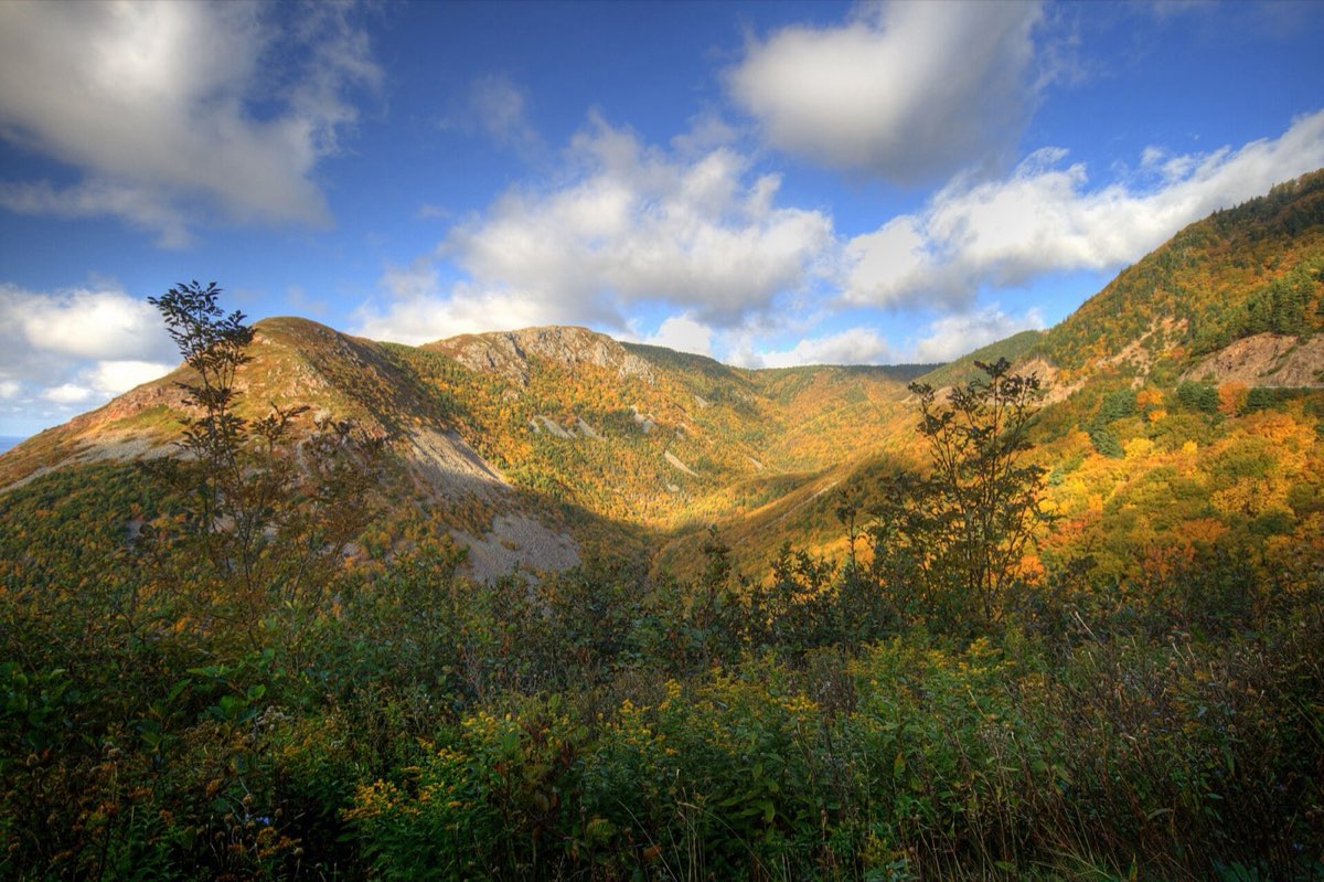
The Cabot Trail is a 300 kilometre loop around northern Cape Breton, and roughly a third of it passes through Cape Breton Highlands National Park, where the road climbs onto a plateau and drops back to the sea repeatedly. It regularly appears on lists of the world's best drives and, unusually for such lists, it deserves it.
Entrances and getting there
The loop starts three and a half to four hours from Halifax: Trans-Canada to Baddeck, then pick a direction. Sydney's airport is about 90 minutes away if you are flying in. The park itself has two entrances on the trail, at Chéticamp on the west side and Ingonish on the east, with a visitor centre and passes at both.
The 4-day plan
Baddeck to Ingonish, clockwise. Driving clockwise keeps you in the outside lane for the views.
- 09:00 Alexander Graham Bell National Historic Site Bell summered in Baddeck for 37 years. The hydrofoil and giant kite work is stranger than you expect.
- 11:30 Cape Smokey The lookoff where the trail first climbs above the Atlantic.
- 13:00 Ingonish Beach Salt water on one side of the barrier beach, the freshwater of Freshwater Lake on the other. Swim your pick.
- 15:00 Middle Head Trail A 3.8 km walk down the narrow headland splitting two bays, past the Keltic Lodge. Eagles overhead most days.
Which direction to drive
Counter-clockwise puts you on the inside lane, which is easier and less exposed. Clockwise puts you on the ocean side, which gives better views and easier pullouts but a more nervous drive. Most locals suggest counter-clockwise for the first lap. Allow three days rather than one, because doing the loop in a day means seeing it through a windscreen.
Location: Cape Breton Highlands National Park
Stops worth making
- Skyline Trail: a boardwalk out to a headland above the Gulf of St Lawrence, with a good chance of moose and, in summer, whales below. The single most popular walk in Nova Scotia. Go at sunset.
- Middle Head: a peninsula walk from the Keltic Lodge with sea on both sides.
- Pleasant Bay: whale watching boats, with pilot whales close to shore through the summer.
- Meat Cove: outside the park at the island's northern tip, down a gravel road, and about as far as you can drive in Nova Scotia.
- Ingonish and Cheticamp: the two gateway towns, one Gaelic-rooted and one Acadian, which makes the loop a cultural crossing as much as a scenic one.
Autumn, which is the main event
Cape Breton's hardwood forests turn in early to mid-October, and the combination of colour and coastline is genuinely rare. It is also the busiest and most expensive fortnight of the year on the island. Book accommodation months ahead if you are coming for it.
Music
Cape Breton fiddle music is a living tradition rather than a tourist show. Look for a ceilidh in a community hall or the Celtic Music Interpretive Centre in Judique. Ask locally, since the good ones are advertised on paper notices rather than online.
Book it and check it
- Official Parks Canada page Fees, conditions, closures and trail reports. https://parks.canada.ca/pn-np/ns/cbreton
- Parks Canada reservations Campsites, oTENTiks and shuttles, each opening on its own launch day. https://reservation.pc.gc.ca
- Cabot Trail information Route planning, communities and seasonal openings around the loop. https://cabottrail.travel
Common questions
- How long does it take to drive the Cabot Trail?
- The loop is about 300 kilometres and takes roughly five hours of pure driving, but three days is the right allowance to actually stop, hike and eat along it.
- Which direction should you drive the Cabot Trail?
- Counter-clockwise keeps you on the inland lane, which most people find less nerve-wracking. Clockwise gives better ocean views and easier pullouts.
- When is peak fall colour on the Cabot Trail?
- Usually the second and third weeks of October, though it shifts a week either way with the season. Accommodation books out well ahead for it.
- Is the Skyline Trail worth it?
- Yes. It is an easy 7 kilometre loop to a headland boardwalk with excellent odds of moose and, at sunset, one of the best views in Atlantic Canada.
Tip
Much of the Cabot Trail has patchy mobile coverage between towns. Pull the plan down for offline use before you leave Baddeck.