
On this page
Kootenay is a long narrow park either side of Highway 93 South, running from the continental divide down to the Columbia Valley. It is the least visited of the four contiguous mountain parks and the easiest to fold into a drive between Banff and the interior of British Columbia.
Entrances and getting there
Highway 93 South is the park. It enters at Castle Junction on the Trans-Canada between Banff and Lake Louise, crosses the divide at Vermilion Pass, passes the historic warden station at Kootenay Crossing, and leaves through Sinclair Canyon at Radium Hot Springs. There are no other roads in. Passes are sold online and at the Radium visitor centre.
The 3-day plan
Yoho’s waterfalls and the lake that outshines its neighbours.
- 08:30 Spiral Tunnels Viewpoint Watch a freight train enter the mountain and cross above its own tail. Trains pass every 30 to 60 minutes.
- 09:30 Takakkaw Falls Canada’s second highest waterfall at 373 metres, a ten minute walk from the lot. The access road’s switchbacks are closed to trailers.
- 12:00 Field Lunch in the two-street railway village. The visitor centre handles Lake O’Hara and Burgess Shale bookings.
- 13:30 Natural Bridge The Kicking Horse River has bored through its own rock dam and keeps drilling.
- 14:45 Emerald Lake Walk the 5.2 km shoreline loop. The colour is real and strongest June through September.
Stops along the highway, north to south
- Marble Canyon: a short interpretive walk over a deep, narrow limestone gorge with meltwater roaring through it.
- Paint Pots: iron-rich ochre springs that stain the ground orange. Indigenous peoples collected pigment here for centuries and the site remains culturally significant.
- Numa Falls: a five minute stop and a good one.
- Sinclair Canyon: the highway squeezes through a red rock gap at the southern gate, which is a dramatic way to exit a park.
- Radium Hot Springs: Canada's largest hot spring pool, odourless, at the south entrance, and the correct end to any day in the mountains.
Location: Kootenay National Park
Fire history you can read from the road
Large sections of Kootenay burned in 2003 and again since, and the standing grey trunks alongside young growth are visible for kilometres. It is a genuinely instructive drive: the lodgepole pine here needs fire to open its cones, so what looks like devastation is the forest's own reproduction cycle.
Hiking
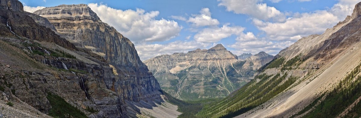
Stanley Glacier is the standout day hike, roughly 10 kilometres return through burnt forest into a hanging valley, with fossils in the rubble at the top. Kindersley Pass is a much harder full-day loop with a ridge walk and near-guaranteed solitude.
Book it and check it
- Official Parks Canada page Fees, conditions, closures and trail reports. https://parks.canada.ca/pn-np/bc/kootenay
- Parks Canada reservations Campsites, oTENTiks and shuttles, each opening on its own launch day. https://reservation.pc.gc.ca
- Radium Hot Springs The mineral pools at the south gate. Open year round. https://www.hotsprings.ca
Common questions
- Is Kootenay National Park worth a stop?
- Yes, especially in transit. Marble Canyon and the Paint Pots are short walks right off the highway, and Radium Hot Springs at the south end is worth the drive on its own.
- How long does it take to drive through Kootenay?
- About 90 minutes without stopping, and half a day if you take the three or four short walks along the way.
- Do you need a park pass to drive Highway 93 through Kootenay?
- If you stop and use park facilities, yes. Simply transiting without stopping does not require one, but any pullout or trailhead does.
- What is the best hike in Kootenay?
- Stanley Glacier, roughly 10 kilometres return, through fire-regenerated forest into a hanging valley with fossil beds at the top.
Tip
Radium at the south gate is a good overnight if you are heading toward the Okanagan, and it is markedly cheaper than anywhere inside Banff.