
On this page
Olympic is really three distinct parks sharing a boundary: a temperate rainforest, 70 miles of wild Pacific coast, and a glaciated alpine core. No road crosses the middle. Everything is reached by spurs off US 101, which loops the peninsula, so the trip is a circle and the order you drive it matters.
Entrances and getting there
- Olympic fills the centre of the Olympic Peninsula, west of Seattle across Puget Sound. No road crosses the park: US-101 loops around it and every section is a spur off that loop.
- Port Angeles is the main gateway, about two and a half hours from Seattle with the Bainbridge Island ferry, and the base for Hurricane Ridge.
- Hoh, Sol Duc, Staircase and Quinault each have their own entrance station on their own spur road.
- Coming up from the south, Lake Quinault is the first stop, about 90 minutes from Olympia.
The loop, in order
- 1 Hurricane Ridge from Port Angeles: an hour up to alpine meadows and a view across to Canada. Do it on the clearest day you get, because it is often in cloud.
- 2 Lake Crescent: startlingly clear glacial water, and the short Marymere Falls walk.
- 3 Sol Duc: hot springs and a fine waterfall, a worthwhile detour.
- 4 Hoh Rainforest: the Hall of Mosses is a short loop through the most photographed rainforest in America. Go early, the lot fills and the road in is long.
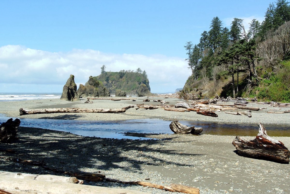
- 5 Rialto, Ruby and Second Beach: sea stacks, driftwood the size of buses, and tidepools. Check a tide table, because several beach walks are only passable at low tide.
- 6 Lake Quinault: the quiet southern rainforest, and a good last night before turning back toward Seattle.
Location: Olympic National Park
Weather, honestly
The Hoh receives up to 14 feet of rain a year. July, August and September are the dry months and even then a jacket is not optional. If you come outside that window, come expecting rain and choose the rainforest and coast over the ridge, since the alpine will simply be inside a cloud.
Tides are a planning input here
Several of the coastal walks cross headlands that are only passable around low tide, with the ones that are not marked by overland rope routes. Getting this wrong strands people every year. Pick up a tide chart at any visitor centre and read the beach map before you set out.
Book it and check it
- Official park page Entrance fees, opening hours, park maps and seasonal road status. https://www.nps.gov/olym/index.htm
- Current conditions and alerts Road, trail and weather status. Read this the morning you go. https://www.nps.gov/olym/planyourvisit/conditions.htm
- Recreation.gov Campsites, timed entry and permits for most federal land. https://www.recreation.gov
- Wilderness permits Needed for all overnight backcountry trips, including coastal camps. https://www.recreation.gov/permits/4098362
Common questions
- Where is Olympic National Park?
- On the Olympic Peninsula in Washington's northwest corner, across Puget Sound from Seattle. Port Angeles, the main gateway town, is about two and a half hours from Seattle using the Bainbridge Island ferry, or three hours driving around through Tacoma.
- How many days do you need for Olympic National Park?
- Four to see the rainforest, the coast and the alpine ridge without rushing. The park sections are one to three hours apart by road, so day-tripping between them wastes a lot of time.
- Can you drive through Olympic National Park?
- No road crosses the interior. US 101 loops around the peninsula and every part of the park is reached on a spur road off it.
- What is the best time to visit the Hoh Rainforest?
- July to September for the driest weather, and first thing in the morning for parking and for the light through the mist.
- Do you need a permit to hike in Olympic?
- Day hiking needs only park entry. Every overnight backcountry trip, including on the beaches, needs a wilderness permit and an approved bear canister in many areas.
Tip
The three sections are far enough apart that a single base does not work. Plan on moving your accommodation at least twice, and put the drives into your plan as real stops so you can see the day they consume.